The Itinerary Trap: When Every Stop Gets Equal Weight
A short-break itinerary works better when each stop has a clear purpose, helping you choose what to keep, what to drop, and where to leave room.

An equal-weight itinerary can turn a relaxed weekend into a chain of handoffs: leave the station, find the market, hurry to the museum, then cross town for lunch. A short-break itinerary works better when each stop has a clear purpose, because the route can respond to how the day actually feels instead of demanding that every saved place be visited.
The trouble is not collecting ideas. It is letting every idea dictate the same kind of commitment. A useful plan links places by the experience they offer, the route they share, or the conditions they need—not by the fact that they all appear on a map.
Why does a route feel crowded before the day begins?
A list often mixes very different things: a timed exhibition, a restaurant recommendation, a pleasant street, and a scenic detour. Put them all in one route and they can look equally fixed, even though one may need advance planning while another is only appealing if you happen to pass it.
Maps can also make distance look simpler than it feels. A short line between two pins may involve a steep hill, a busy crossing, or a change in the day’s mood. Walking, waiting, finding the entrance, and choosing where to sit take attention too. When those transitions are treated as blank space, the schedule can become tiring without looking crowded.
Instead of asking how many stops fit, ask what connects them. A route can follow a neighborhood, a view, a craft tradition, or a change in atmosphere. That connection gives the day shape without requiring every place to become a destination.
How can a short-break itinerary follow a natural route?
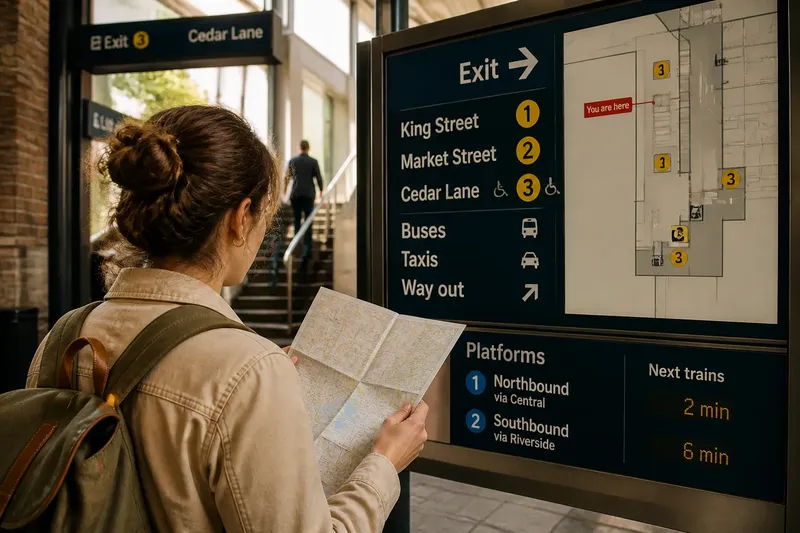
Begin with the starting point you already have: your hotel, train station, or first appointment. Look at a walking map and note barriers as well as distance—waterfronts, major roads, hills, and transit lines can shape a route more than pins suggest. Google Maps or Apple Maps can help compare paths; a paper street map can make neighborhood patterns easier to see at a glance.
Then choose a direction of travel rather than drawing a loop through every recommendation. If the morning begins near the old station, for example, a route might move through the historic center toward the river, with a café or bench as a natural pause. A separate attraction across town can stay off that route unless it has a particular reason to pull you there.
Check the practical details that could change the sequence. Confirm current opening information for venues you intend to enter, note any timed admission, and see whether transit or access conditions affect the route. Keep those facts attached to the relevant place; they need not turn the rest of the day into a timetable.
What makes one stop fit beside another?
Proximity helps, but a good pairing also respects pace and atmosphere. A quiet garden may pair naturally with a slow lunch nearby, while a lively market might lead into a street-food stop or a browse through adjoining lanes. Two nearby attractions can still feel like a poor combination if one calls for concentration and the other requires a rushed transfer.
Use these questions to decide whether a stop belongs on the route:
- What is the actual path? If the map shows a direct, walkable connection, keep the pairing in view; if a barrier or awkward transfer breaks it, choose transit, reroute, or leave one place for another outing.
- Do their rhythms match? If both places suit a slow, unhurried stretch, pair them; if one demands a fixed arrival while the other rewards wandering, protect the fixed visit and make the other conditional.
- Does the second stop add a new texture? If it offers a different experience, such as a view after an indoor visit, consider it; if it duplicates the first, pick the one that fits the route or your interest better.
- What would make you leave? If weather, energy, or a closing time changes the appeal, decide on an alternate route or a nearby pause; if nothing meaningful changes, keep the plan simple.
- Is there a comfortable stopping point? If a café, public square, or riverside bench sits naturally along the way, use it as a place to pause; if not, identify a convenient place to sit before committing to the longer stretch.
- Can the route work without this pin? If removing it leaves a coherent day, keep it as an optional detour; if the route loses its purpose, reconsider the starting point or choose a different anchor for the outing.
These checks are not a scoring system. They help expose the practical reason for keeping or dropping a stop, so your route reflects the place rather than the length of your saved list.
How do you adapt the route when plans change?
Think in terms of a main path and nearby alternatives, not a string of appointments. A main path should be easy to explain in one sentence: “Walk from the station through the market quarter to the river.” Alternatives can sit close to that path, ready for a change in weather or interest, without forcing a cross-town detour.
Say you arrive at a fictional riverside town with a paper map, a phone, and three saved places: a covered craft hall near the station, a small history museum uphill, and a lookout at the far end of the river walk. You want an easy afternoon and have no timed booking. First, trace the route from the station to the craft hall and confirm the museum’s current opening details. Next, notice that the lookout requires continuing along the exposed river path, while the craft hall offers an indoor stop and the museum adds a climb. If rain begins, you can visit the hall and then decide whether the museum still appeals; if the sky clears and you feel energetic, continue to the lookout. The resulting choice is concrete: the craft hall supports the afternoon’s purpose, while the other two depend on conditions rather than competing as obligations.
For companions, compare routes as well as interests. One person may want the museum, another the river. You might walk together to the museum, then split for a while if the route and meeting point make that easy; or choose the shared walk and leave the museum for another visit. Saying what each option costs in time, effort, or missed experience is clearer than trying to disguise a conflict with extra stops.
What do travelers ask about short-break routes?
How do I plan a walking route between attractions?
Start from a real point, such as your lodging or station, and connect places that share a neighborhood or direction. Check the route for barriers, hills, crossings, and convenient places to pause before treating the map line as a comfortable walk.
Should I use Google Maps or a paper map?
Google Maps and Apple Maps are useful for current routing and transit options, while a paper map can make nearby streets and districts easier to compare. Use whichever helps you see the route clearly, and verify venue details separately with the venue.
How can I keep a route flexible in bad weather?
Identify indoor places near your main path and check their current opening information before relying on them. If conditions turn, choose a nearby indoor stop or shorten the walk rather than forcing the original route.
What if two places are close but feel like a poor pairing?
Keep them separate if their pace, atmosphere, or practical demands clash. A short distance is a convenience, not a reason to visit both.
How can a route leave room for the place itself?
Leave the map open to small discoveries: a shaded square, a bookshop with an inviting window, or a side street that feels worth following. That space is useful only if the route does not quietly treat it as room for another planned stop.
A short-break itinerary is easier to enjoy when its route has a reason, its pauses are visible, and its alternatives stay close at hand. Before setting out, check the route once more against your starting point and the experience you want; then let the streets decide whether the next turn is worth taking.